One can use T3D2 to either display some airspace using a homegrown xml format.
Or use the Openair format converter to kml. But kml does not cater in the extrude for altitude.
One can add to add Flying Site Air Space Information in form of a
AirSpace.xml file.
From and To are in feet altitude values
Type is CTR, TMA, FAP,...
Radius is in Nautical Miles
<AirSpace_around_Site >
<AirSpace Type="FAP" From="0" To="7600" >
<Box >
<Corner ID="1" NS="-25.75" EW="28." />
<Corner ID="2" NS="-25.8" EW="28." />
<Corner ID="3" NS="-25.8" EW="27.8" />
<Corner ID="4" NS="-25.75" EW="27.8" />
</Box>
</AirSpace>
<AirSpace Type="TMA" From="7600" To="14500" >
<Cylinder NS="-26.01" EW="28.2" Radius="25" />
</AirSpace>
</AirSpace_around_Site >
An Airspace can be a combination of a Box and a Cylinder
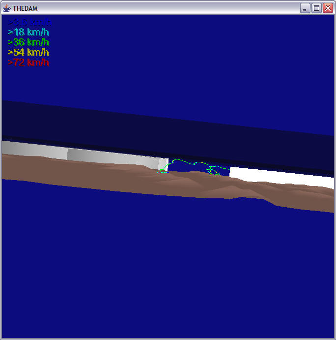
Airspace around The Dam area, Wonderboom, Lanseria, Pellindaba and a TMA on
top
<AirSpace_around_Site >
<AirSpace ID="FAP-64" Type="FAP" From="0" To="7000" >
<Box >
<Corner ID="1" NS="-25.758" EW="27.98" />
<Corner ID="2" NS="-25.816" EW="27.99" />
<Corner ID="3" NS="-25.825" EW="27.9" />
<Corner ID="4" NS="-25.76" EW="27.9" />
</Box>
</AirSpace>
<AirSpace ID="JHB076" Type="TMA" From="7600" To="11000" >
<Cylinder NS="-26.01" EW="28.2" Radius="35" />
</AirSpace>
<AirSpace ID="JHB110" Type="TMA" From="11000" To="45000" >
<Cylinder NS="-26.01" EW="28.2" Radius="60" />
</AirSpace>
<AirSpace ID="FAWB" Type="CTR" From="0" To="7600" >
<Box >
<Corner ID="1" NS="-25.53" EW="28.12" />
<Corner ID="2" NS="-25.55" EW="28.36" />
<Corner ID="3" NS="-25.716" EW="28.35" />
<Corner ID="4" NS="-25.714" EW="28.11" />
</Box>
<Cylinder NS="-25.622" EW="28.115" Radius="5" />
<Cylinder NS="-25.633" EW="28.355" Radius="5" />
</AirSpace>
<AirSpace ID="FALA" Type="CTR" From="0" To="7600" >
<Box >
<Corner ID="1" NS="-25.8666" EW="27.8666" />
<Corner ID="2" NS="-26.00" EW="27.983" />
<Corner ID="3" NS="-26.083" EW="27.883" />
<Corner ID="4" NS="-25.966" EW="27.783" />
</Box>
<Cylinder NS="-25.93" EW="27.92" Radius="5" />
<Cylinder NS="-26.02" EW="27.83" Radius="5" />
</AirSpace>
</AirSpace_around_Site >
The code requires a fixed, strict format.
A * in column 1 is an indication of an end of airspace. No * allowed inside a airspace definition at the beginning of a line.
The data formats are fixed, no extra blanks allowed.
CONVERT/OPENAIR and in the WORK Directory choose an openair txt file. And kml file gets created.
http://www.winpilot.com/UsersGuide/UserAirspace.asp
http://www.sssa.org.za/wgc2001/documents/Safrica.air
https://164.214.2.62/products/digitalaero/index.cfm
http://soaring.aerobatics.ws/SOARING/JL/SUA/EU.html
Special Use Airspace
OpenAirtm
Airspace and Terrain description language is an easy to use and publicly
available standard for displaying map information.
User can add or modify the data himself, therefore having a full control over
what is being displayed on the screen.
For a list of available airspace files see our airspace directory.
NEW: WinPilot Version 1.130 and
later:
In addition to 'Airspace.txt', now WinPilot also reads a file called 'Terrain.txt'.
Both files can contain all OpenAir commands.
The intention of the 'Terrain.txt' file is to separate terrain description from
airspace description.
The restriction of the maximum number of labels created by the AT command has
been changed from 3 to unlimited.
There are two new map elements meant for displaying
terrain and geographic features
(they differ from airspace in that they don't have popup labels attached):
TO {string} ; Declares Terrain Open Polygon; string - name (optional)
TC {string} ; Declares Terrain Closed Polygon; string - name (optional)
This commands make it easy to define things like lakes, roads, borders, etc
For example, to draw a lake using light blue color and a dark blue 1-pixel
wide, solid border, that is visible at zoom levels 100km or closer, the
following commands can be used:
TC Lake Tahoe
SP 0, 1, 0, 0, 255
SB 200,200,255
V Z=100
DP 38:56:00 N 120:02:00 W
DP 38:56:40 N 120:04:00 W
DP 39:00:00 N 120:05:55 W
DP 39:01:45 N 120:07:00 W
DP 39:03:40 N 120:07:00 W
DP 39:05:00 N 120:09:00 W
DP 39:10:30 N 120:07:30 W
DP 39:11:00 N 120:06:00 W
...
The three new commands seen above are:
SP - Select Pen - corresponds to Win32 API CreatePen
SB -Select Brush - corresponds to Win32 API CreateSolidBrush
and V Z=number (select a zoom level above which the element will not be
displayed)
SP style, width, red, green, blue ; Selects Pen (border) to be used in drawing
PEN STYLES in SP command:
SOLID 0
DASH 1
NULL (transparent=no border displayed) 5
Example: for a 1 pixel wide, dashed, light gray pen use: SP 0,1,192,192,192
SB red, green, blue ; Selects Brush (interior) red, green, blue can range
from 0 (least intensity) to 255 (max intensity)
Example: to select white interior of a closed
polygon, use: SB 255, 255, 255
To select transparent interior use: SB -1,-1,-1
The SP and SB commands can also be used to alter the default colors of airspace
segments.
For example, to change the default color of class C airspace from dark gray to
magenta, use: 'SB 180,0,180' in the first class C segment definition,
like this:
AC C
AN RENO-C
AL SFC
AH 8400 ft
SB 180,0,180 *select MAGENTA as the default for class C
V X=39:29.9 N 119:46.1 W
DC 5
For a definition of OpenAir, see the listing below:
******* OPEN AIR (tm) TERRAIN and AIRSPACE DESCRIPTION
LANGUAGE *************
* Version 1.0
* December 10, 1998
* Updated October 15, 1999
* Send comments to jerryp@winpilot.com
*
*
* AIRSPACE related record types:
* ==============================
*
* AC class ; class = Airspace Class, see below:
* R restricted
* Q danger
* P prohibited
* A Class A
* B Class B
* C Class C
* D Class D
* GP glider prohibited
* CTR CTR
* W Wave Window
*
*
* AN string ; string = Airspace Name
* AH string ; string = Airspace Ceiling
* AL string ; string = Airspace Floor
* AT coordinate ; coordinate = Coordinate of where to
place a name label on the map (optional)
* ; NOTE: there can be multiple AT records for a single
airspace segment
*
*
* TERRAIN related record types (WinPilot version 1.130 and newer):
* ==============================
*
* TO {string} ; Declares Terrain Open
Polygon; string = name (optional)
* TC {string} ; Declares Terrain Closed
Polygon; string = name (optional)
* SP style, width, red, green, blue ; Selects Pen to be
used in drawing
* SB red, green, blue ; Selects
Brush to be used in drawing
*
*
* Record types common to both TERRAIN and AIRSPACE
* =================================================
*
* V x=n ; Variable assignment.
* ; Currently the following variables are supported:
* ; D={+|-} sets direction for: DA and DB records
* ; '-' means counterclockwise
direction; '+' is the default
* ; automatically reset to '+' at the
begining of new airspace segment
* ; X=coordinate : sets the center for the following
records: DA, DB, and DC
* ; W=number : sets the width of an airway in nm
(NYI)
* ; Z=number : sets zoom level at which the
element becomes visible (WP version 1.130 and newer)
*
* DP coordinate ; add polygon pointC
* DA radius, angleStart, angleEnd ; add an arc, angles in
degrees, radius in nm (set center using V X=...)
* DB coordinate1, coordinate2 ; add an arc, from
coordinate1 to coordinate2 (set center using V X=...)
* DC radius ; draw a circle (center
taken from the previous V X=... record, radius in nm
* DY coordinate ; add a segment of an
airway (NYI)
* SAMPLE OpenAir(tm) File (for Minden, NV):
* Reno Class C
AC C
AN RENO-C
AL SFC
AH 8400 ft
V X=39:29.9 N 119:46.1 W
DC 5
* Reno Class C
AC C
AN RENO
AL 7200 ft
AH 8400 ft
* this item will have 3 labels
AT 39:36.8 N 119:46.1W
AT 39:22.8 N 119:45.1W
AT 39:29.9 N 119:36.1W
V X=39:29.9 N 119:46.1W
DA 10,270,290
DA 7,290,320
DA 10,320,200
V D=-
DA 5,200,270
AC C
AN BEALE AFB
AL SFC
AH 4100 ft
V X=39:08.2 N 121:26.2 W
DC 5
AC C
AN BEALE AFB
AL 2600ft
AH 4100 ft
AT 39:10.2 N 121:17.2 W
DA 10,9,130
V D=-
DA 5,130,9
AC C
AN BEALE AFB
AL 1600ft
AH 4100 ft
AT 39:06.2 N 121:35.5 W
DA 10,130,9
V D=-5
DA 5,9,130
AC C
AN SACRAMENTO/MCCLEAN
AL 1600 ft
AH 4100 ft
V X=38:41.7 N 121:35.4 W
DA 10,164,40
V X=38:40.0 N 121:24.0 W
DA 10,344,219
******************* RESTRICTED ********************
AC R
AN R 4812 4804
AL 0
AH FL 180
V X=39:13:00 N 118:13:00 W
DA 5,0,178
V D=-
V X=39:10:20 N 118:37:00 W
DA 5,175,355
AC R
AN R-4803 S
AL 0
AH FL180
V X=39:20:00 N 118:52:00 W
DA 3,27,270
DP 39:35:00 N 118:59:20 W
DP 39:36:00 N 118:53:30 W
AC R
AN R-4806 W
AL 0
AH UNLIM
DP 36:41:00 N 115:56:10 W c29
DP 37:06:00 N 115:56:10 W c30
DP 37:06:00 N 115:35:00 W c31
DP 37:16:55 N 115:35:00 W c32
DP 37:16:55 N 115:18:10 W c34
DP 36:38:08 N 115:18:10 W c35
DP 36:25:40 N 115:18:10 W c36
DP 36:25:40 N 115:23:20 W c37
DP 36:35:00 N 115:37:00 W c38
DP 36:35:00 N 115:53:00 W c39
DP 36:35:45 N 115:56:10 W c40
AC R
AN R-4806 E
AL 100 Agl
AH UNLIM
DP 37:16:55 N 115:18:10 W c34
DP 36:38:08 N 115:18:10 W c35
DP 36:47:40 N 115:07:00 W c41
DP 37:11:45 N 115:07:00 W c42
DP 37:16:55 N 115:11:00 W c43
AC R
AN R-4807 A
AL 0
AH UNLIM (Mon-Fri)
AT 37:28:00 N 116:36:00 W
DP 37:53:00 N 117:06:00 W
DP 37:53:00 N 116:55:30 W c1
DP 37:47:00 N 116:55:30 W c2
DP 37:33:00 N 116:43:20 W c3
DP 37:33:00 N 116:26:20 W c4
DP 37:53:00 N 116:26:20 W c5
DP 37:53:00 N 116:11:00 W
DP 37:42:00 N 116:11:00 W
DP 37:42:00 N 115:53:00 W c6
DP 37:33:00 N 115:53:00 W c7
DP 37:33:00 N 115:48:00 W c8
DP 37:28:00 N 115:48:00 W c9
DP 37:28:00 N 116:00:00 W c10
DP 37:16:00 N 116:00:00 W c11
DP 37:16:00 N 116:11:10 W c12
DP 37:20:00 N 116:11:00 W c13
DP 37:23:00 N 116:17:15 W c14
DP 37:23:00 N 116:22:15 W c15
DP 37:21:00 N 116:27:00 W c16
DP 37:21:00 N 116:34:10 W c17
DP 37:16:00 N 116:31:00 W c18
DP 37:08:00 N 116:27:00 W c19
DP 36:55:00 N 116:27:00 W c20
DP 36:55:00 N 116:34:00 W c21
DP 36:51:00 N 116:34:00 W c22
DP 37:26:25 N 117:04:45 W c23
DP 37:32:30 N 117:05:55 W c24
DP 37:53:00 N 117:06:00 W c25
AC R
AN R-4807 B
AL 0
AH UNLIMITED
DP 37:16:00 N 116:11:10 W c12
DP 37:20:00 N 116:11:00 W c13
DP 37:23:00 N 116:17:15 W c14
DP 37:23:00 N 116:22:15 W c15
DP 37:21:00 N 116:27:00 W c16
DP 37:21:00 N 116:34:10 W c17
DP 37:16:00 N 116:31:00 W c18
AC R
AN R-4808 N
AL 0
AH UNLIMITED
DP 37:28:00 N 115:48:00 W c9
DP 37:28:00 N 116:00:00 W c10
DP 37:16:00 N 116:00:00 W c11
DP 37:16:00 N 116:11:10 W c12
DP 37:16:00 N 116:31:00 W c18
DP 37:08:00 N 116:27:00 W c19
DP 36:55:00 N 116:27:00 W c20
DP 36:55:00 N 116:34:00 W c21
DP 36:51:00 N 116:34:00 W c22
DP 36:51:00 N 116:26:45 W c26
DP 36:46:00 N 116:26:45 W c27
DP 36:41:00 N 116:15:00 W c28
DP 36:41:00 N 115:56:10 W c29
DP 37:06:00 N 115:56:10 W c30
DP 37:06:00 N 115:35:00 W c31
DP 37:16:55 N 115:35:00 W c32
DP 37:28:00 N 115:35:00 W c33
AC R
AN R-4808 S
AL 0
AH UNLIMITED
DP 36:46:00 N 116:26:45 W c27
DP 36:41:00 N 116:15:00 W c28
DP 36:41:00 N 116:26:45 W
AC R
AN R-4809
AL 0
AH UNLIMITED
DP 37:53:00 N 116:55:30 W c1
DP 37:47:00 N 116:55:30 W c2
DP 37:33:00 N 116:43:20 W c3
DP 37:33:00 N 116:26:20 W c4
DP 37:53:00 N 116:26:20 W c5
AC R
AN R-4810
AL 0
AH 17000ft
V X=39:10:20 N 118:37:00 W
DA 5,293,215
V X=39:09:00 N 118:42:00 W
DA 3,159,347
AC R
AN R-4811
AL 0
AH 15000ft (Mo-Fri)
V X=38:14:40 N 118:38:40 W
DC 1.5
AC R
AN R-4813
AL 0
AH FL180
V X=39:51:20 N 118:21:00 W
DA 13,165,255
DP 39:51:15 N 118:37:35 W
DP 40:01:20 N 118:15:00 W
DP 40:01:20 N 118:00:55 W
DP 39:58:20 N 118:00:55 W
AC R
AN R-4816S
AL 500 ft agl
AH FL180
DP 39:17:20 N 118:20:30 W
DP 39:18:20 N 117:59:00 W
DP 39:21:00 N 117:55:00 W
DP 39:24:30 N 117:52:00 W
DP 39:26:50 N 117:51:08 W
DP 39:30:00 N 117:49:00 W
DP 39:34:00 N 117:41:20 W
DP 39:34:00 N 118:12:30 W
DP 39:30:00 N 118:15:18 W
AC R
AN R-4816N
AL 1500 ft agl
AH FL180
DP 39:34:00 N 118:12:30 W
DP 39:51:20 N 117:59:55 W
DP 39:51:20 N 117:31:00 W
DP 39:34:00 N 117:40:00 W
************* ALERT ************
AC R
AN A-481
AL 7000ft
AH 17000ft
AT 36:21.0 N 115:22.0 W
DP 36:14.2 N 115:02.0 W
V X=36:14.2 N 115:02.0 W
DA 30,274,307
************* CLASS D ***********
AC D
AN NAS-FALLON
AL 0
AH 6400ft
V X=39:25.0 N 118:42.0 W
DC 6
AC D
AN LAKE TAHOE
AL 0
AH 8800ft
V X=38:53.6 N 119:59.7 W
DC 5
************* Wave Windows ***********
AC W
AN Minden West
AH Ask on 122.8
AL 18000 ft
DP 39:04:00 N 119:57:00 W
DP 39:04:00 N 119:41:00 W
DP 38:42:00 N 119:38:00 W
DP 38:42:00 N 119:57:00 W